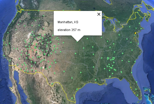
It is useful to be able to display geo-located sites (longitude and latitude) in Google Earth. This is done through the use of KML (Keyhole Markup Language) files. It is not hard to do, but it does require learning a little about KML, an element-based scripting language similar to HTML. There is an excellent tutorial HERE. As a typical example, you can look at the KML file used to display all of NOAA's Climate Reference Network sites, as shown in the image below for the continental US, HERE. This file was generated (using PHP) from a file containing names and locations for all the CRN sites.
It is also possible to use Excel to create .kml files. You can find a template for such a file HERE. This template creates a file for displaying the first site in the USHCN file list – the site at Barrow, AK. Instructions for adding more sites and converting the Excel file are given in that file.
The default marker for geo-located sites is a yellow "map pin" icon In this case, the default icon has been replaced by a plain green "paddle" icon. There are many available icons, which are loaded from a google.com website when the Google Earth application is opened. A left-click on the icon will open a box with the site name and elevation.
The file linked here has a .txt extension (KML_CRN.txt).
To use it in Google Earth, copy and save it with
a .kml extension. Then when you double click on the file it should automatically start Google Earth and
display the locations on the usual interactive Google Earth globe model. If you
left-click on a site, you will see a box with the name of the site and its elevation.